Inside Park
WIM Local Event on Sunday 19 November 2017
Dick Keighley: Thanks to Andrew Howard for the planning and map updates, Chris Branford as Organiser and all those who helped on the day in various guises. Thanks also to Jeremy Cooper, the landowner for letting us use his woodlands and the campsite facilities.
Andrew Howard: I always think planning will make me a better orienteer. It hasn't happened after my previous efforts, but I'm certainly more conscious now of the amount of time mappers spend interpreting the land to give us a decent canvas to run on.
Inside Park was last used in 2011, so I was anticipating there being quite a few updates to make to the map, but fresh from a day learning to do basic surveys and a day on using OCAD, I was confident that I could make the necessary updates.
A key learning point for me was how quickly the forest changed as we moved from September to event day. I did the bulk of the mapping in late October, but the leaf fall and the ongoing work of foresters, mountain bikers and charcoal burners continued to change the landscape in the days up to race day.
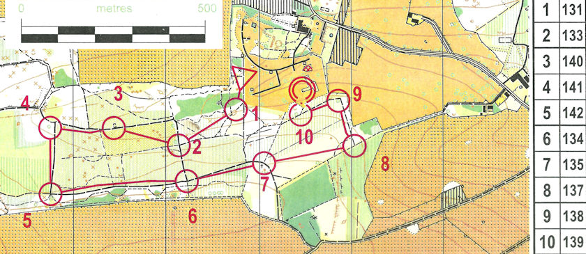
Consequently, of my initial list of 35 possible control sites, only 3 were used. I think of Inside Park as 3 blocks of forest, the largest of which had undergone extensive felling all along its central block, the depth of the brambles made this now unusable. I'd planned for all 4 line courses to use this area, so I was quickly looking at plan B.
In the past, the forest immediately south of the park had been enclosed, this had now been opened up to the extent that I could place a control or two in there. New tracks also meant the white and yellow could be routed round the forest near to the parkland, enabling children to finish and go straight into the play park while sending parents to download.
The middle block of forest changed a lot in the autumn, the orange course upwards visited here. On race day the runability was better than mapped and in hindsight, I could have added some more controls further east of this block. However, I was put off by the active electric fence around the enclosure.
The southern block of forest is definitely the most pleasant for orienteering with largely runnable woodland. This enabled me to have a few T4 legs which foxed a couple of competitors who are just starting out on light green. I wish I'd added a couple more controls in the south to tempt more of the score competitors down to there. The only trouble with using the southern end of the map is that you have a bit of a flog back up the hill.
Thanks to all of you that gave me feedback on the control sites and map. I've made a few updates before sending the map for electronic storage. If you look back at the 2011 map, you'll see that the area had changed massively with a significant number of tracks, most of which I picked up using a GPS while riding my bike. The course times were pretty much within the expected range, so I'm pleased that despite the brambles and muddy bits, courses were as good as they could have been given the constraints of the area.
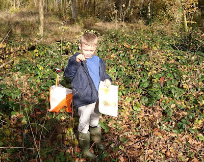
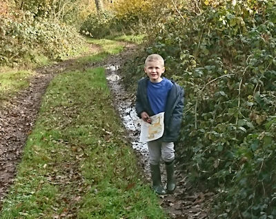
Above: the Yellow course. Below: a young competitor on the Yellow.